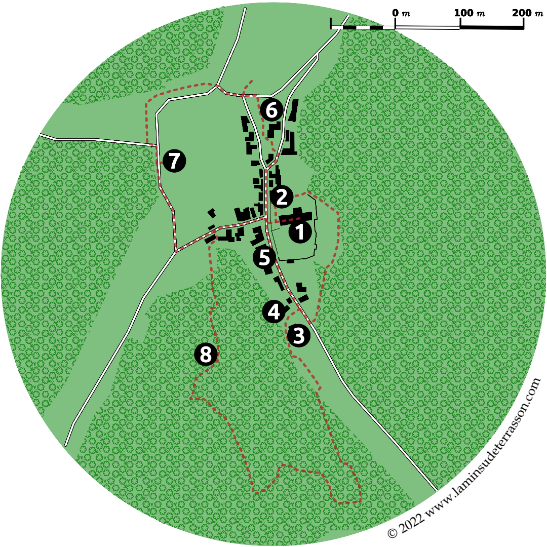
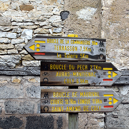
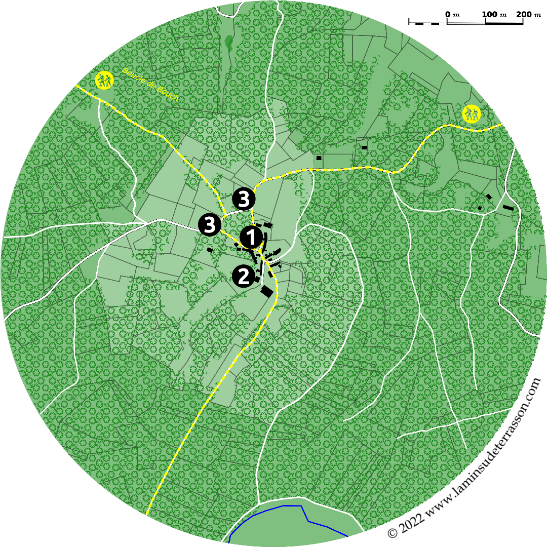
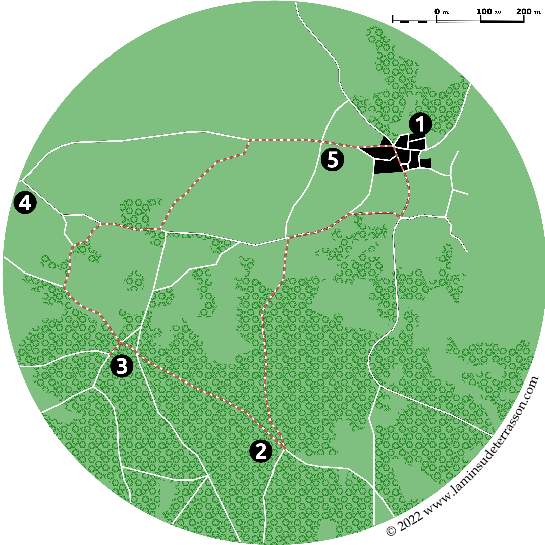
La Min-sú de Terrasson

retreat, reflect, refresh


Coly valley hikes

J
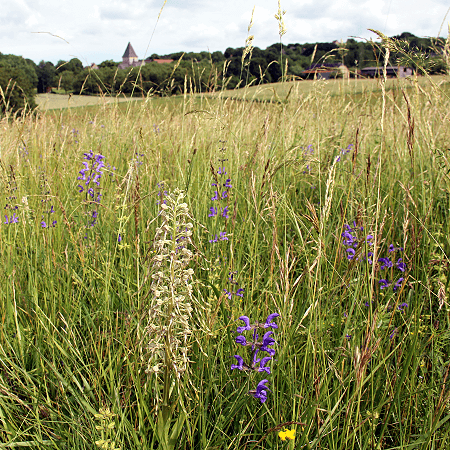
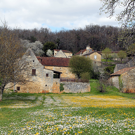
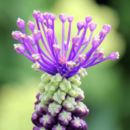
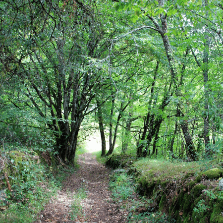
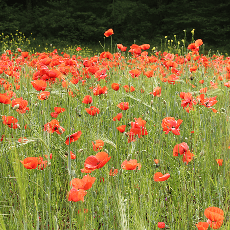
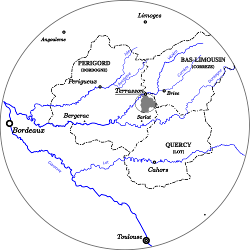
ust to the South of Terrasson, the Coly stream cuts through steep hills with a remarkable geology: Jurassic formations to the north and Cretaceous to the south. Small streams drain some 170 km2 of undulated forestland, scattered with rich agricultural valleys, grasslands, walnut groves, villages and small hamlets.

map_location_coly-watershaed
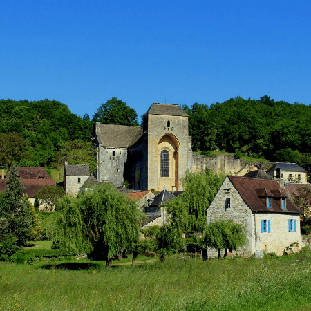
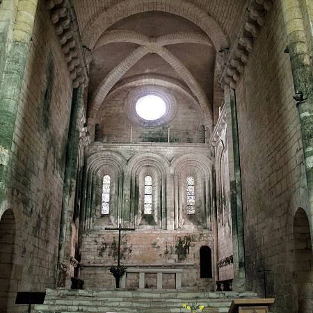
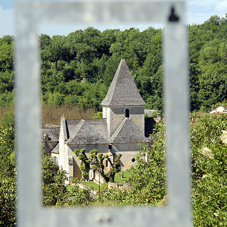
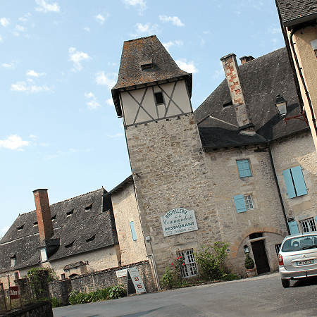
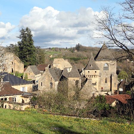
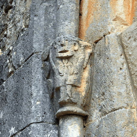
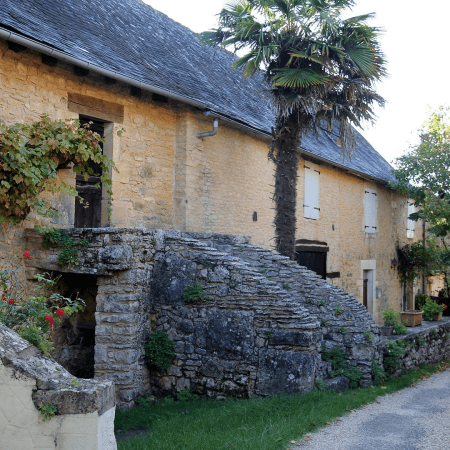
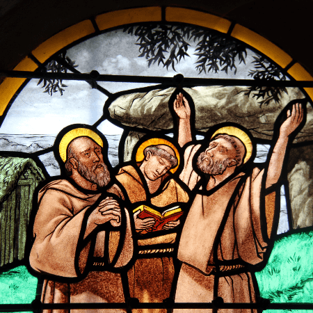
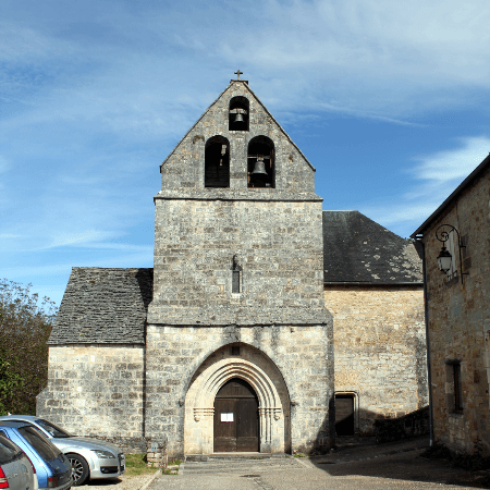
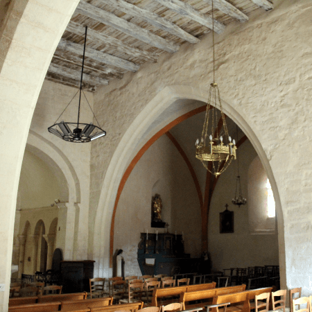
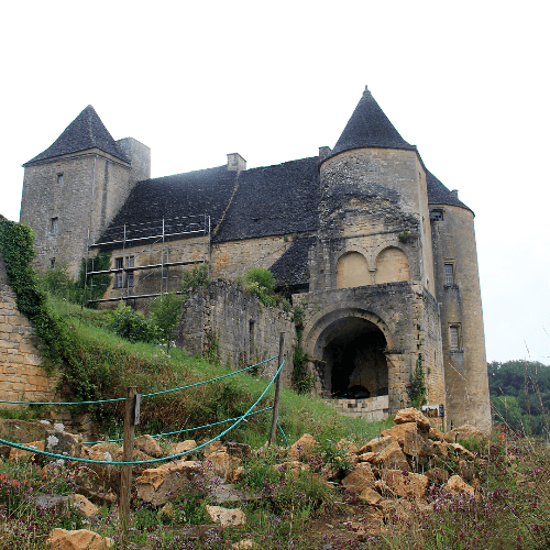
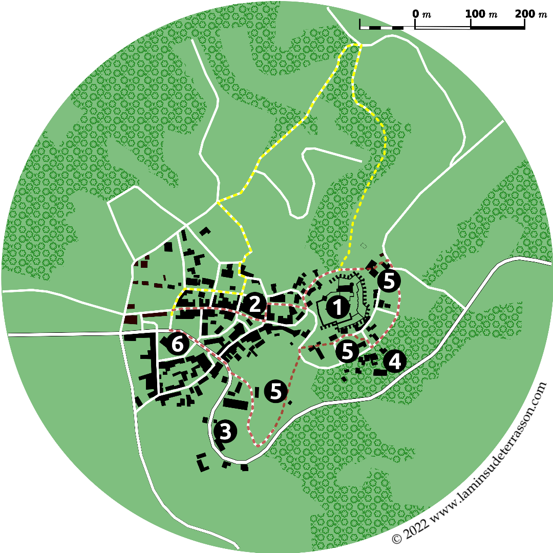
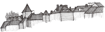
Including Saint Amand de Coly classified as one of France’s most beautiful villages and the hamlet of Chapelle Mouret protected Architectural, Urban and Landscape Heritage Protection Zone (ZPPAUP - Zone de Protection du Patrimoine Architectural, Urbain et Paysager).


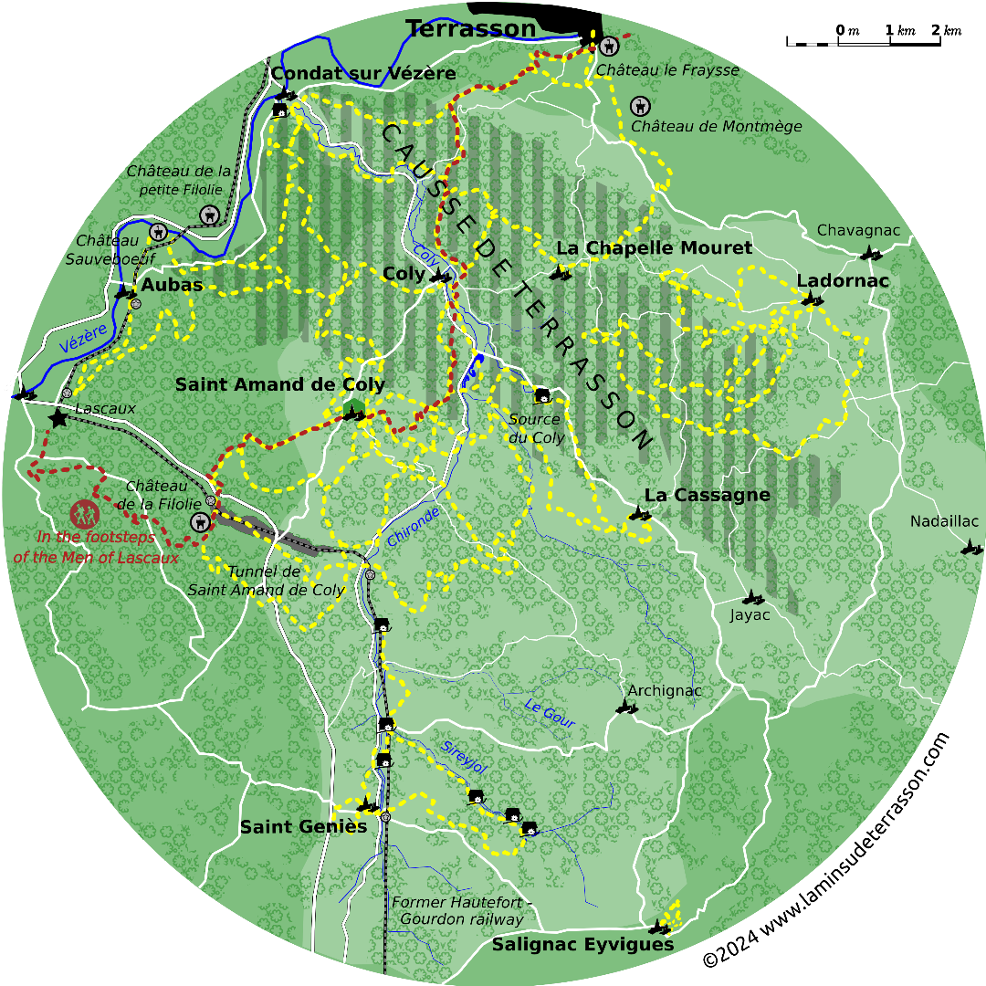
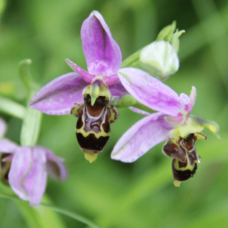
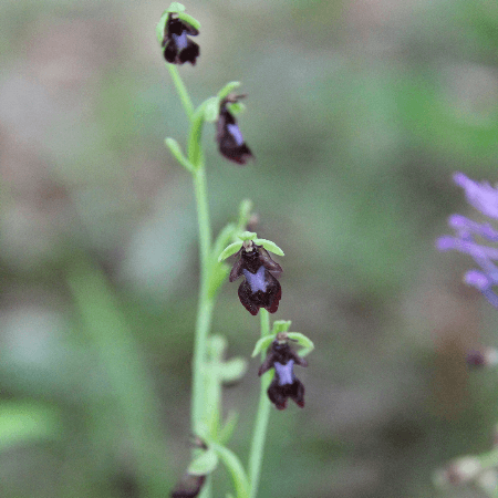
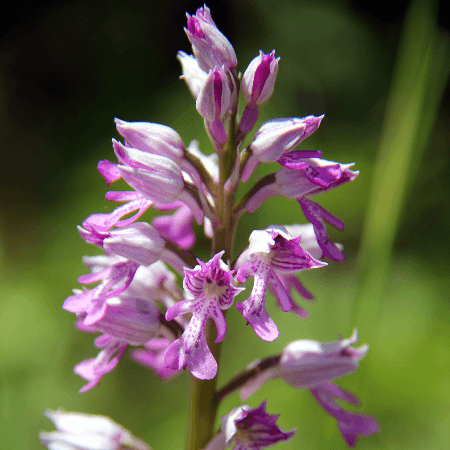
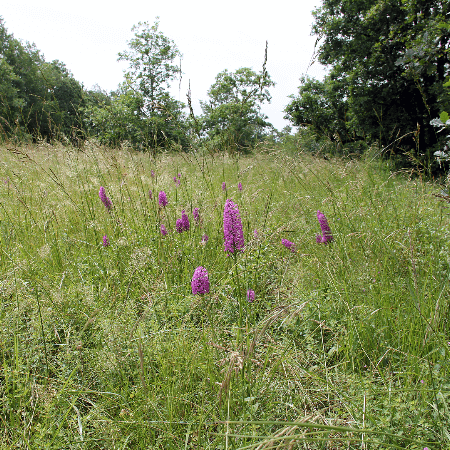
The Causse de Terrasson is a large natural area of ecological interest (ZNIEFF: Zone Naturelle d'Intérêt Ecologique, Faunistique et Floristique) encompassing representative environments of the Périgordian causses: to the north the hills are covered with a mosaic of pubescent oak forests, juniper heaths and lean grasslands. To the south forest of chestnuts and hornbeam.

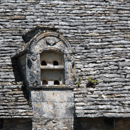
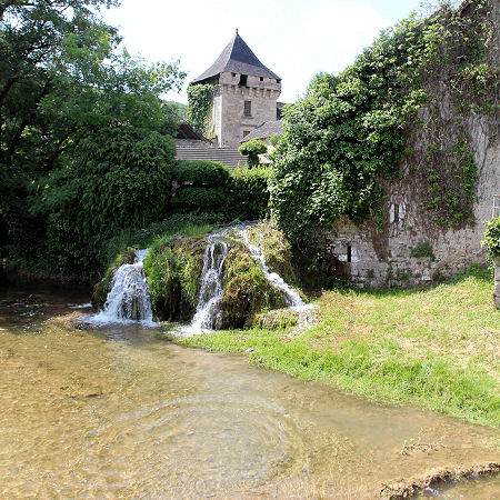
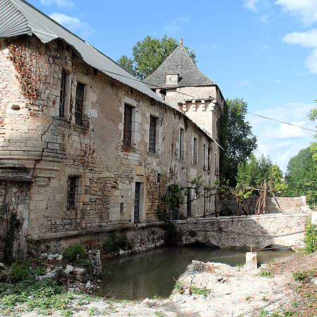
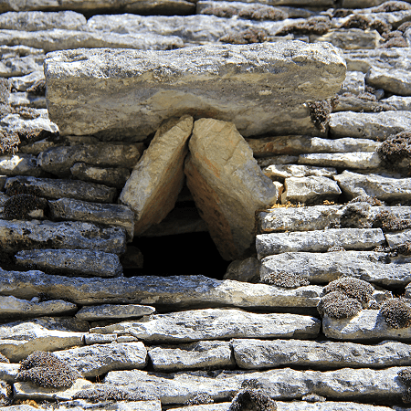
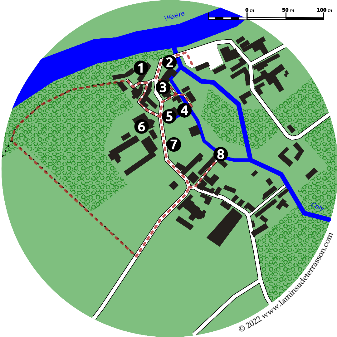
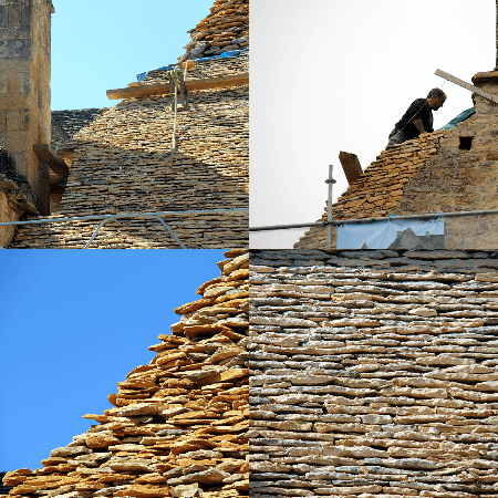
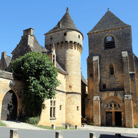
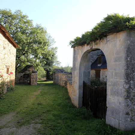
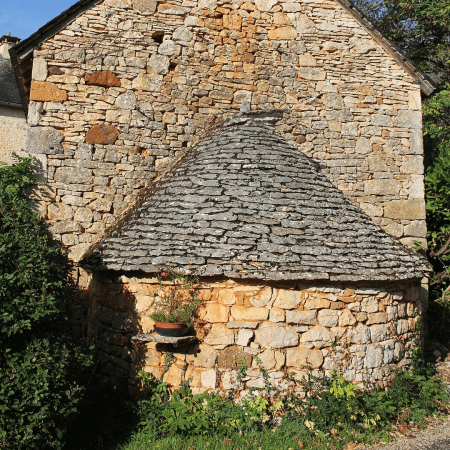
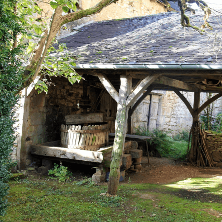
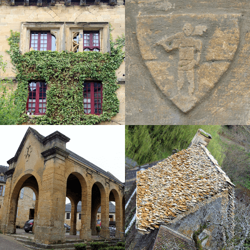
The Coly stream falls into the Vézère at Condat-sur-Vézère, once the principal seat of the Hospitallers with dependencies in La Cassagne and Ladornac. Upstream, the Chironde tributary supports a series of watermills, on its upper reaches the village of Saint Geniès with its remarkable concentration of vernacular architecture and its typical lauze (dry stacked natural stone) roofs.


The Villages

Saint Amand de Coly


The village of Saint-Amand-de-Coly is classified as one of 'France's most beautiful villages'. Explore the village and its surroundings on foot, or by renting an 'all terrain bike'.


A little history
According to the legends, sometime halfway the 6th century, during the reign of king Clovis I, a young noble man from the Limousin arrived to accept a monastic life. Amand followed Sore and Cyprien to the Merovingian monastery of Genouillac (now Terrasson) and after a long stay there, the three 'saints to be' decided to separate and live as solitary hermits. Amand found a cave not far from Genouillac in what was to become Saint-Amand-de-Coly.

During his life Amand evangelized the local population whom declared him a saint. After his death a monastery and village grew around his grave. The first known historic document referring to the monastery dates from 1047. Though there is mention of destruction here by Normans in 857, the year the Saint Sore monastery of Terrasson was plundered and raised to the ground. In 1101 it is decided to hand the monastery of Terrasson to the Benedictine order, prompting a core group of the monks to leave for Saint-Amand, where they established a Augustinian order.

We now enter the middle ages with its own wars and ravages. The construction of the outer walls was probably started during the 100 year war, it was during the wars of religion that the protestants sacked the monastery and sought refuge in 1575, when canons had to be brought from Brive to chase them out. Some of the resulting holes in the walls are still visible today. It was during this time the tomb of Saint Amand was destroyed.

The monastery becomes the milking cow of the Sauvebeuf family whom milked it dry for 182 years at the end of which little more then a ruin remained, by 1738 only three monks are left. After the revolution all monasteries were nationalised and sold-off, the village is renamed Amand-le-Vallon. The abbey church became the village church but it not till 1886 some serious restoration work starts.

Sights
With a total depth of 48m, width of 27m and height of 8m the impressive fortified church dominates the village. The construction took most of the 12th century. Based on a Latin cross layout, oriented east-west. The defence walls measure 300m and enclose an area of 5000m2. The church was converted into a fortress but despite its additional defences it remains a beautiful Romanesque church with simple lines and a simple interior. Its defences include very thick walls, exits for archers and several blind staircases.

The historical walk of about 1km starts by exploring the church (1), the guardhouse (2) and the defense walls. It then explores the heritage of the village; the former drying shed for tobacco (3; now community hall), the drying shed for wallnuts (4;now tea room), the 'romanesque house' (5), the village well, the presbytery, the former hospital (6) and its washing area. The walk then provides some good views of the village (7), before returning. Alternatively there is a 2,5km 'nature trail' (8) close to the village.

Hiking and biking
Saint-Amand is the starting point for the following hikes, which also double as 'all terrain bike' (VTT) trails (do not try these on a standard bike). There is an all terrain bike rental (VTT) available in the village.

Hiking trails starting from Saint-Amand
> Boucle Soleil et Ombrage; 4,2km – 1,5h.
> Boucle Bois et Près; 8km – 2,5h.
> Boucle des Rapiettes; 4km – 1h.
> Boucle des Murailles; 6,5km – 2h.
> Boucle Lauzes et Vielles Pierres; 14,2km – 4,5h.
> Boucle Vallées et Côteaux; 16,2km – 5h.
> Boucle Tunnel, Bois et Eaux; 12,5km – 4h.
> Boucle de Château de La Filolie; 16,1km – 5h.
> Boucle Entre Bois et Lauzes; 7,2km – 2h.

La Cassagne


This small commune in a well preserved landscape, has a 14th century church, and 15th century presbytery at its heart. La Cassagne has a 1.7km walk passing the bourg, fields, walnut groves and hamlets. It is also the starting point for a 11,7 km 'Boucle de la source de Coly'.


The small community invites you to explore its natural and cultural heritage. The church of Saint Barthélémy (1) and its presbytery (2) are superb examples of vernacular architecture with their impressive 'lauze' (dry stacked) roofs. The church, presbytery, cemetery cross and the adjacent 'grange' (XIIIth century barn marking the presence of the Knight Templars) are all recognized as historical monuments.

The trail leads you through the walnut-grove passing the walnut drying shed (3) and up to the departmental road. You could cross this road and walk up the to the hamlet of Jarnel (4). The marking in the key-stone over the gate: 1791 PPPP (Pauvre Plaideur Prend Patience) is a reminder of the leading position La Cassagne occupied after the revolution when the population of every 'chef lieu' elected in 'judge of the land' for its own tribunal. Until the creation of the 'Canton de Terrasson' in 1800, the surrounding villages of Archignac, Jayac, Saint Amand de Coly, Saint Geniès, Palin and Ladornac settled their differences here.

The walk however turns left, through the fields in the direction of the former castle. On the doors and windows of the small houses (5) on the right and left you will discover decorative stones that once belonged to the feudal castle. After the revolutions locals were encouraged to bring down these 'symbols of oppression' and serve themselves with whatever they could use. All that remains of the castle are the surrounding walls (with the base of a round tower clearly visible). In place of the castle a 'maison bourgeoise' was constructed in the 1800's (6).

The free standing pigeonnier (pigeon tower) is another beautiful example of vernacular architecture. Dating back to the 12th century you will find it has, halfway-up the side, a 'randière' to prevent small rodents from climbing up the wall to steal pigeons or their eggs. Inside there are 800 'pigeon holes' on 3 levels. Just under the roof (protected from the weather) you can make out some patterns painted in yellow and red, it is thought the whole walls was originally painted, and is still topped with a dry stacked 'lauze' roof.

From here the walk leaves the paved road to follow the old gleigier path (7) (trail that served the hamlets of la Roche, Captus and la Rynie to get to the church). 'Gleigier' in the occitan language signifies 'of the church', along the path you will find 25 different trees and shrubs labeled with their occitan, french and scientific names. The trail passes through more walnut-groves and then steeply up to the hamlet of Genèbre (8).

Here you find the walnut oil mill (with direct sales), and two somewhat enthusiastic dogs. Walk around the buildings and get to the covered 'fontaine' and 'lavoir' (9). This well was enclosed with a little building during the 100 year war and has provided the village with water just until 1981. The adjacent washing area was used by the women of the hamlets to wash cloths and exchange information. From here you walk back to the church...

Currently the source of the Coly is found at the watermill of La Doux close to La Cassagne. Previously it was located close to Saint-Amand-de-Coly. Legend has it a local farmer could just save his life (and that of his oxen) when, whilst he was ploughing a field, the new source opened and started to spray out water.

The 10-meter deep spring has since attracted much attention, between 1965 when the first serious exploration took place and the 1980s when researchers managed to explore the underground river for 3km. In 1991 they passed the 4km mark (which was a world record at the time) and in 2003 they managed to swim 5,88km.

The hike will lead you through forested hills and past the source of the Coly:

Hiking trails starting from La Cassagne
> Boucle de la Source de Coly; 11,7km – 4h.

Condat-sur-Vézère


The Coly stream once powered two watermills in Condat-sur-Vézère before dropping into the Vézère through a little cascade. The village has been home to the Gaulois and the Romans and was a base for the Hospitallers whom left their mark.


The name Condat derives from the gallic word 'condate', meaning 'confluence of two rivers', in this case the Vézère and the Coly. The first writings evoking Condat go back to the Middle Ages. Today the village is known as Condat-sur-Vézère (occitan Condat de Vesera) to avoid confusion as the name is 'Condat' is quite common.

Condat was occupied by the Order of Knights of the Hospital of Saint John of Jerusalem (also known as Knights Hospitalier or Hospitallers for short) from the 12th till the 18th century. After the conquest of Jerusalem in 1099 during the first crusade, the organization became a religious and military order charged with the care and defence of the Holy Land. Pope Clement V dissolved the rival order, the Knights Templar, in 1312 and turned over much of their property to the Hospitallers.

The village was the seat of the principal commandery of the Hospitallers which had authority over a genuine network of commanderies of the Périgord. The commanders had the right on high and low justice and his authority was exercised over the many possessions in Périgord. From 1291 to 1790, thirty commanders succeeded one another in Condat. During the wars of religion the parish of Condat was devastated several times.

The commandery of Condat has conserved the majority of the buildings as they were (re)constructed under the command of François de Touchboeuf Clermont by 1540. The small watermill (1), large watermill with the common bread oven (2) (four banal), the church (3), prison (4), commanders lodge (5), noble house of Verdier (6), remnants of the ancient enclosure wall (7) and fishponds. The Hospitallers exploited the hydrolic power of the Coly through mills to work grain, nuts and hemp though this last 'fulling mill' has today disappeared.

From the Castle of Condat, the 16th century lodge remains and the 14th century prison tower, registered as historical monuments since 1948. The rectangular building has an adjacent square on one side, fishpond and ramparts on the other, and in the opposite corner a 16th century tower. The Romanesque church of Notre-Dame-et-Saint-Jean-Baptiste, dates back to the 12th century with its fortified flat bell tower with four bays, that is accessible through a staircase in the right buttress. The old residences include the noble house of the Verdier and some half-timbered (à colombage) houses (8).

The four banal (commune oven) is a reminder of the restrictions in feudal tenure in France which obliged peasants to use the facilities of their lords, until the 18th century. These included the required use-for-payment of the lord's mill to grind grain, his wine press to make wine, and his oven to bake bread. Both the manorial lord's right to these dues and the banality-dues themselves are called droit de banalité. The object of this right was qualified as 'banal', e.g. the four banal.

La Commanderie, former 13th century safekeeping post of the Knight Hospitallers, is a historic place that nowadays serves day menus inside its dining room with thick walls and vaulted ceiling, or outside in its parkland gardens.

You can walk around Condat in 30 minutes or hike one of the following trails:

Hiking trails starting from Condat-sur-Vézère
> Boucle de la Commanderie; 9km – 3h.
> Boucle du Pech; 2,7km – 1h.
> Boucle de Maurival; 11,6km – 3h.

Saint-Geniès


Typical village located in the heart of the Périgord Noir, Saint Genies is located on the Chironde a tributary of the Coly. It is known for the important architectural ensemble of beautifully restored local stone buildings and lauze roofs.


On the central square a market is held every Sunday morning, in July and August, the Wednesday night market allows you to buy and consume on the spot. From December to February the Sunday morning truffle market brings together local producers.

In 1200 the village is acquired by Boson de Salignac and mention of the lordship of Saint Geniès appears towards 1282. In 1327 it is the co-lords of Val, Salignac and Saint Genies authorizes Gaubert de la Caminade to build the Cheylard chapel. The date the original castle was destroyed is unknown, the current castle (1) dates from the XVIth century, when several houses (elements of the XIIIth century) were united. Of the XIIth century castle only a vestiges of the dungeon (2) remain.

From the Romanesque XIIth century church of Notre Dame de l’Assomption (1) only the apse remains. The side chapels date from the XIII, XV, and XVIth centuries, the bell tower near the end of the XVth century . The church was devastated during the wars of religion. The chapel of Cheylard (or Saint Catherine chapel) (3) has survived in its original form, its XIVth century frescoes are of particular interest. It was recognized as a historical monuments in 1899. The middle section of the north wall depicts Saint Thomas Becket (Archbishop of Canterbury between 1162 and 1170), a popular saint in the Périgord and Limousin during the Angevine (‘English’) empire.

Saint Geniès has an exceptional heritage of lauze roofs, thanks to a 'dynasty' of lauzier masters. Classified as an UNESCO Intangible Cultural Heritage (ICP) Mr. Chapoulie is also responsible for the upkeep of beautiful Perigord Noir castles like Castelnaud, Fenelon, Marqueyssac and even the Maison de la Sirène in Collonges-la-Rouge, Corrèze. The lauzes are between 2 and 6 cm thick and weight between 500 and 800 kg per m2, so a solid oak frame with chestnut slats is needed. When restored, a roof is first 'rissonnee' (hedgehogged) to check and clean the existing stone. Then redone from bottom to top on a 'bench'.

Saint Geniès is at the start of a number of hikes, the 50 minutes ‘Promenade the bourg’ offers some great views, whiles the 11/15 km ‘Boucle du Sireyjol et de la Chironde’ explores the Watermills and small cultural heritage like the lavoir (4), former railway station (5) and pigeon-towers (especially recommended during the European Mill days and National Heritage Weekend when mills are open for visits).

Hiking trails starting from Saint Geniès
> Boucle Pierres et Lauzes; 15,5km.
> Boucle des Moulins; 7,7km.
> Boucle des Etangs; 7,7km.
> Boucle des Combes; 15,4km.

Chapelle Mourat


Surrounded by forest this small hamlet was created by monks as a dependency to the monastery of Terrasson. The XIIth century chapel at it’s center, originally dedicated to ‘Our Lady of Maurès’, could accommodate fifteen people. Burned by the English in 1450, it was rebuilt and through a series of transformations the chapel grew into a small church. The monks original purpose for the settlement seems to have been the cultivation of vines.


The carte d'état-major (map produced between 1820 and 1866) shows vineyards surrounded the hamlet, just before the 1880 phylloxera epidemic decimated them. Having lost their purpose, the properties were sold to private individuals. By 1903 there was still a population of 137, today only 9 permanent residents remain, going up a little in summer as holiday makers occupy cottages or second homes.

By the 1990’s the local government of Terrasson recognized the unique authenticity and coherence ‘of the whole’ (ensemble) worthy of preservation. Constituting elements are: The forest clearing, ‘corderc’, romanesque church (1.), cemetery, enclosure and park of the old presbytery, wine maker’s houses with their typical exterior staircases ‘a bolets’ dating from the 17, 18 and 19th centuries, two stone crosses (3.), and walnut plantations. In the Occitan tradition, a couderc refers to the central square around which the village or hamlet is organized which often includes common facilities like the bread oven, fountain, ‘travail’ (2.) or place where animals can drink.

The challenge to preserve ‘the authentic image of the hamlet in the heart of a forest’ was included in Terrasson’s municipal council’s proposal for a Architectural, Urban and Landscape Heritage Protection Zone (ZPPAUP: Zone de Protection du Patrimoine Architectural, Urbain et Paysager).

Bringing together all heritage protection measures; the preservation of sensitive archaeological sites, historic monuments, buildings of architectural interest, homogeneous urban complexes, natural spaces and landscape heritage. The zone, covering nearly 1078 hectares, was created in 1995. Under the proposal the ‘travail’ , a device designed to immobilize horses and oxen during shoeing (métier à ferrer) and the bread oven of Chapelle Mourat’s corderc were restaured.

Walking around the hamlet a disused wine press at the back of the church and the ‘a bolets’ wine makers houses are reminder of the past wine cultivation. This type of houses are a signature for the peasant of the Causses with their living quarters located upstairs whiles the ground floor/basement, provided space for a few animals, workshop and wine making. Because the zone is a living landscape (not a museum) preservation measures do not exclude agricultural activity on the clearing nor the rehabilitation of residential buildings (though subject to certain limitations), they do excludes new constructions other than those required for farming.


Chapelle Mourat lies at the southern point of the 17.6 km / 6 hours (or the shortened 12.6 km / 4 h) ‘Boucle de Bouch’ hiking trail starting from Terrasson.


La Dornac


La Dornac (officially, but also known as Ladornac), is a small rural community that is part of the communauté de communes of Terrasson. Population peaked in 1830’s at around 1000 inhabitants, dipped to 250 in the 1980’s, and has since increased to 400. This increase is mostly due to its position in the aire d'attraction de Brive-la-Gaillarde. The shift from agricultural (wine) production to a commute village is most notable in the bourg, which in 1830’s had 200 inhabitants but today only supports 20. Despite the small population a ‘multiple rural’ serves as bread depot and bar-restaurant with a terrace.


The bourg is small but has an interesting cluster of buildings surrounding the Notre-Dame Church (1), once the seat of a preceptory of the knights Hospitallers. Built on a steep slope in a number of phases. The paneled rectangular nave was added to the 12th century vaulted choir which supports the 3-levels defense tower. The keep had breteches and hoards allegedly strong enough to refuse to receive Bertran de Goth, future Pope Clement in 1304.

To the north side of the nave a smaller chapel covered with a lauze roof and, to the south, a large rectangular Gothic chapel were added in the 16th century. The capitals are carved with interlacing, foliage and figures. The bands of Caroligian tradition on two of them are reminiscent of Romanesque art from the second half of the 12th century. A belfry-wall, to the west, dominates a portal with three broken arches.

The main attraction of la Dornac is its access to the surrounding Causse Terrassonnais through a number of hiking trails. To walk the 2,5km sentier d’interprétation pick-up the booklet at the bar-restaurant. Or walk the 9,6 Boucle de St.Chaubrant (also known as Des bois et des pierres indicated in yellow), the 10km Orchidées sauvages et petit patrimoine (indicated in blue), or the 16 km A la découverte de la faune et la flore sauvage (indicated in red). The walks are exploring the natural and cultural heritage dotting the landscape including the drystacked walls and cabanes reminders of wine cultivation, the truffières (2) and traces left by the charcoal makers (charbonnières). Bring a pick-nick to the cabane de la Louise (3) or other dedicated pick-nick areas along the trails.

If you happen to be in the area during the spring (April-June) a visit to the wild orchid site (4) is a must. Local enthusiast Josiane Glaudon updates the indicators on the side, and will guide on request. An information panel does help the individual visitor. Please be careful not to step on the orchids, and do not gather flowers or plants. The community organizes or participates in activities throughout summer often using the community hall (5) to welcome and shield participants.

Hiking trails starting from la Dornac
> Sentier d’interprétation; 2,5km.
> Boucle de St.Chaubrant; 6,9km.
> Boucle des Orchidées sauvages et petit patrimoine; 10km.
> A la découverte de la faune et la flore sauvage; 16km.

Salignac-Eyvigues


Located right on the edge of the Coly watershed, Salignac commands a strategic position descending towards the Vézère river and the Borrèze valley which descends towards the Dordogne river on the other side.


First mention of a castle dates back to the turn of the millennium. Typically enough the original wooden structures start to be replaced by stone buildings in the 11th and 12th centuries, to which date back the two dungeons of the Salignac castle.

The Salignac family is a likely branch of the Viscounts of Turenne. Located on the border of the vicomté de Turenne, the Causse de Martel and the wooded hillsides of Périgord, the village of Salignac is a place of passage between Quercy, Limousin and Périgord. Summer highlights are its popular medieval festivals at the historic village, its events around the farmers market (Tuesday mornings) and Marché gourmand nocturne (Friday evenings) on the Place du champ de Mars (market square).

A walk around the village (promenade du bourg) takes a hour and passes Salignac Castle (1), the 17th century Halle and Hôtel noble des Croisiers (2), Eglise Saint Julien (3), village historique (4), a couple of lavoir (5), Market square (6).

The Salignac Castle has seen a lot of historic changes, reaching its height in the 15th century after which it slowly decayed. The castle suffered damages during the Hundered Years War and the Wars of Religion. During the French Revolution villagers took over the castle, broken it up and sold the lots. By 1910 the main building and guardhouse were still standing. By 1912 the Salignac family bought back the castle and turned the remains into a stately manor, leveling most of the ruins and guardhouse to create a garden around three terraces on different levels.

The castle was abandoned again, and by 2006 found new owners that set-out on a multi-generational journey to restore this historic monument. They worked 15 years to stabilize the site, replace structural beams and redo the ‘lauze’ roof. In 2021, 30 years after its last inhabitants left, the castle reopened its doors to the public. A visit gives you the unique opportunity to visit ‘a work in progress’. Much of the terraces are currently excavated, which allows for a sneak-peak under the surface. The spiral staircase provides access to the basement cut out from the rock, a room ‘left as they found it’, the central part currently under renovation, as well as a restored room with its ‘pisé’ floor and historic decor.

Hiking trails starting from Salignac-Eyvigues
> Promenade du bourg; 2km - 50 mins.
> Sentier des Etreilles; 2,5km - 1 h.
> Boucle d'Eyrignac; 13,7km - 4h30.
> Boucle des Moulins; 9,3km - 3h.
> Boucle de la Forêt; 12km - 4h.


Share this page:
Share on Facebook Share on WhatsApp Pinterest
landscape