History and orientation
Terrasson has a long history. As so often this history was written into the landscape with consecutive peoples erasing and re-writing, cannibalizing the old to build the new. From the pre-roman days little evidence remains. Evidence is circumstantial as roman settlement and very early christian missionary activity must have been attracted to some pre-existing settlement and religious practices.
As this area is easily accessible from Terrasson it allows for in depth exploration of the landscape through one of the many hiking trails. The landscape is shaped by the interaction of the underlying geology, topography, biology, contemporary culture and deep historic factors. Celtic people build their ‘oppodia’ (large earthworks), castles like that of Montmège were later build on them. The Roman empire left its traces in roads and villas with mosaic floors as displayed in the Patrimony House of Terrasson.
The Merovigian and Caroligian ages left fewer marks as they lacked the political organisation and largely build in wood, though some sarcophagi can be seen of Place de Genouillac in Terrasson. And the VIth century hermits: Amand, Cyprien and Sour left their marks by founding monasteries. But a lot of what is visible in the landscape today finds its origins in the XIIth century renaissance.
From the XIth century onward new hamlets and the extension of agricultural land began changing the countryside. This population growth was accompanied by large social changes, were in the Xth century slaves were still common, the practice had practically disappeared in the XIth. The emergence of feudal system replaced the legal inferiority of the non-free with the economic dependence of the peasant.
The peasant gained an interest in the management of ‘his farm’ as he could transfer improvements to his children (though the land was not yet legally his to sell). Relative autonomy and autarky (ability to survive and function without external assistance) shaped a ‘peasant mindset’, still shaping to landscape today (see below).
Though; ‘what the lord gives with the one hand, he takes with the other’. No longer ‘hands-on’, the feudal lordship starts taxation through the exploitation of banalities; the banal press, the market hall and the banal oven…etc., that can still be found scattering the landscape. Water mills start multiplying on the watercourses milling flour, oil, tannin, malt, powering forges, crushing fibres for textile or beating iron.
Because these activities are easily taxable, they increase the income of the lordship, opening new social perspectives to the aristocracy, as well as new investment opportunities ‘for the benefit of all’. It contributes to the resurrection of a monetary economy, neglected in the times of village self-sufficiency since the fall of the Roman Empire.
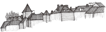
In Aquitaine, castles build in local natural stone become the focal point of a lordships: Prestige, profit and protection go hand in hand, as dungeons, pigeon towers, bridges and large stone enclosures circling the ‘bourgs’ are constructed. Far from the old cities, ‘bourgs’ (big villages) are created at the foot of a castle or monastery, attracting and protecting activities that could further enrich the lordship. However, the ‘free people’ of the bourg (the bourgeois), taking advantage of the rivalries between the local lords and authorities, had to be given various franchises to encourage their settlement.
The same period also sees the growth of pilgrimages to Rome (the tomb of St. Peter), Compostella (the tomb of St. James) and Jerusalem (the Holy land). The ideal lord, the knight of chivalry, goes on a pilgrimage (or crusade metaphorical or for real) for his eternal salvation.
The orders of chivalry; the order of the Temple and the order of St. John of Jerusalem (better know as Knights Hospitalier or Hospitallers for short) emerge in the aftermath of the first crusade. Their support networks of commanderies become effective land exploitations and important actors of economic development. Condat-sur-Vézère was the seat of the principal commanderie of the Hospitallers which had authority over the network of commanderies of the Périgord.
Fortress-like churches in the Romanesque style appear with their massive walls, round arches, small windows and arch framed portals. Exterior decoration of Romanesque churches is relatively simple, inside walls often adorned with frescoes, but few survived as stucco pealed-off and was removed. The bare natural stone walls, clean lines of the arches and domes resonate with the contemporary mindset.
The Romanesque style is a diverse expression of the vernacular, sometimes divided into regional schools of architecture. The Ecole du Périgord typically has a line of cupolas/domes and often a steeple-wall (Un clocher-mur; vertical flat architectural element constructed at the front containing the main entrance and church bells). The most impressive among the Romanesque churches of Périgord is the abbey church of Saint Amand de Coly.
The Merovingian/Visigoth era
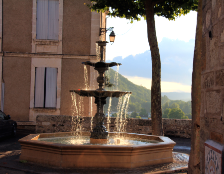
The 'Place de Genouillac' refers to the Merovingian villa that was build here under king Clovis (560 AD), to standardise the christian religion in his realm. Documents describe how 'the three friends': Sour, Amand and Crepin were send here to help with the construction of the villa and instruct the (pre-existing) grouping of monks in the new standardized teachings of the western church. The villa enclosed an area with residences, church and a fountain dedicated to Saint Julian, a roman soldier considered to be the first christian in the area.
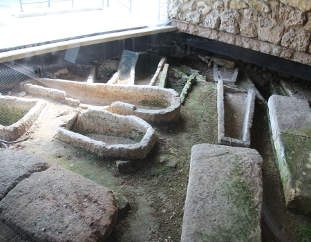
This fountain as natural springs had long been worshiped by the 'pagan' pre-christian population. The villa was destroyed by Viking raiders at the end of the 8th century, the building housing the restaurant 'L'Imaginaire' was rebuild on its fundaments, a rebuild church of Saint Julian was pulled down at the end of the 19th century. Interestingly the fountain of Saint Julian managed to reincarnate and still graces the square. Recently public works uncovered a number of sarcophagus from the Merovingian/Visigoth era (5th century) at the lower end of the square, now preserved in place and open to the public.
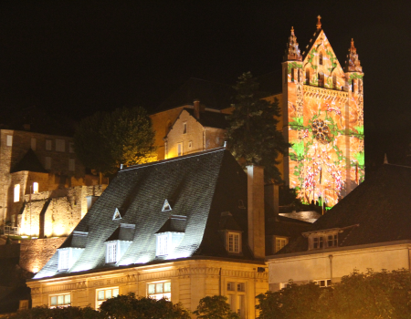
The spirit of Saint Sour endures in the landscape as the hermit, as the story has it, he followed doves he had released and declared 'Terra Sunt' (on earth they are, meaning they have landed)! It's a romantic but disputed notion on how the town got its name, which more probably was derived from the occitane word for a 'small elevated piece of land' that signifies the topography of the place. The 9th century saw continued Norman/Viking invasions which prompted to rebuild the monastery at the higher, better defensible place we find the church of Saint Sour today. Saint Sour was re-buried in the new church, though his grave was destroyed by the protestants during the wars of religion.
Building work has since turned-up what might have been the cover stone of the original grave, which is now displayed in a niche in the right staircase leading up to the church.
The middle ages
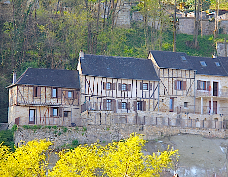
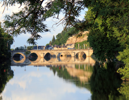
The 12th century saw the construction of the 'old' bridge and watermill as well as major destruction and reconstructions during the Hundred Years' War. During the renaissance things quieted down and beautification of the town took place. During the 'French' revolution clerical buildings got sold or broken down, the monastery got re-purposed. The 'Place Bouquir' with its 'Bouquir home' (dating back to 1614) commemorates Terrasson send a son to the national convention of 1792 in which Gabriel Bouquier voted for the death to the former king and his vote was said to be a critical one. Follow the road down you arrive at the old bridge, follow the road up and you find a beautiful ensemble of buildings at the town gate known as the Brossard de Marvillac castle.
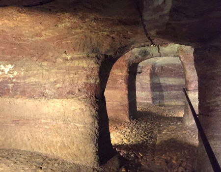
Just off the Place Bouquir you find the 'cluzeau', one of 12 such man-made caves under the centre of the town. The reason behind and time of their construction remain a mystery. As they are too wet to store anything, and support a well on one end, they could have been constructed to hide from Viking invasions. Though others see them as remnant of praying rooms belonging to the first monks that lived here before the construction of the Merovingian villa. A number of other explanations and stories go round, as some of the cluzeau for example provided a hiding place for the resistance during the second world war. An example of re-discovery or re-purposing, but not the actual reason for their construction.
Modern times
In 1833 a new bridge, till this day known as 'the new bridge' was constructed. The 1830s saw the construction of the quay connecting the old and new bridges, the constructing of the harbour facilities and the reconstruction of the octroi building (initially abolished after the revolution). As part of these works the new 'Brive road' was constructed under the Malpas rock as an extension of the quay. It is in one of its 'bourgeois' houses we today locate our min-sú. However, the railway arrived in the 1860s, killing all river trade and sparring a brief period of industrialization.